Significant observation
Harmful Algal Blooms
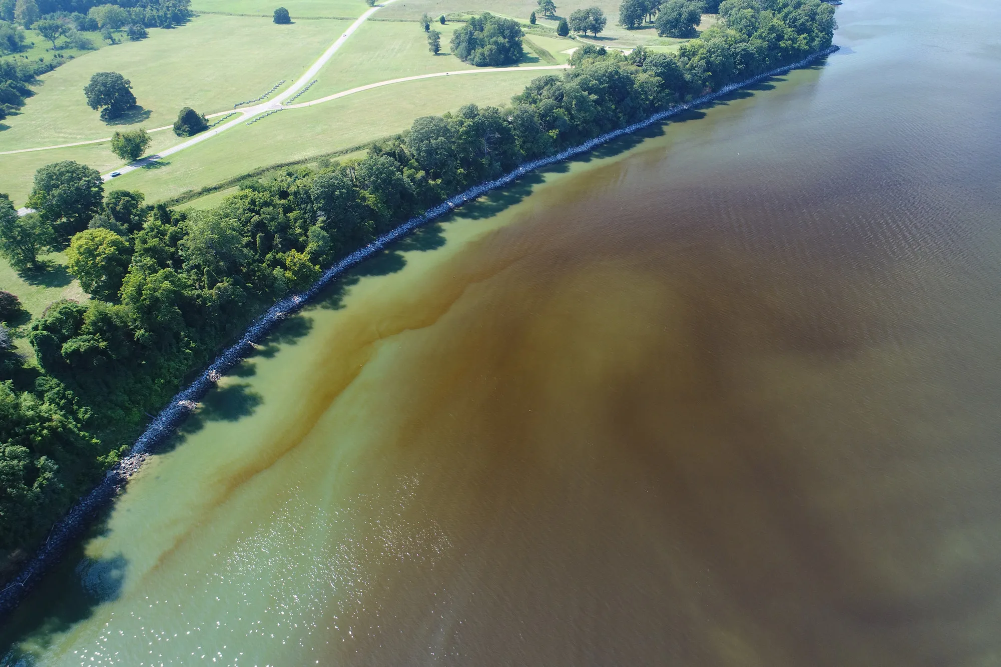
Each summer, dense algal blooms can develop in the lower Chesapeake Bay and its tributaries, discoloring the water and, at high enough concentrations, depleting oxygen and harming the fish, shellfish, and people who depend on the estuary. Blooms are notoriously patchy: they form, drift, and dissipate over hours to days, at spatial scales of tens to hundreds of meters — too fine for satellites to resolve through clouds and too fast for ship surveys to chase.
C4PO observes these events from the air. Beginning with an aerial survey and monitoring program for bloom events in the lower York River, the lab uses drone-based aerial remote sensing to map blooms at the neighborhood scale — in the shallow nearshore waters where blooms concentrate and where conventional platforms struggle to sample. These aerial observations complement in-water sampling and have supported collaborative studies of phytoplankton dynamics and water quality in the Bay.
20262 surveys · 42 photos
August 4, 2026 · Lower York River, Gloucester Point
Drone survey, 11:55–12:14, from the VIMS campus across the Coleman Bridge to the Yorktown waterfront and back.


201711 surveys · 83 photos
August 31, 2017 · Lower York River
Drone survey, 14:48–15:03.


August 30, 2017 · Lower York River
Drone survey, 14:06–14:25.


August 22, 2017 · Lower York River
Drone survey, 14:08–15:24.


August 21, 2017 · Lower York River
Drone survey, 12:03–12:07.


August 16, 2017 · Lower York River
Drone survey, 14:32–15:28.


August 1, 2017 · Lower York River
Drone survey, 13:24–16:19.


July 27, 2017 · Lower York River
Drone survey, 15:10–16:13.


July 26, 2017 · Lower York River
Drone survey, 16:26–17:12.


